


tour du Lac de Flée

avdem
User
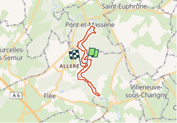

Length
12.8 km

Max alt
340 m

Uphill gradient
192 m
Km-Effort
15.2 km

Min alt
289 m

Downhill gradient
155 m
Boucle
No
Creation date :
2025-04-08 07:37:22.507
Updated on :
2025-04-08 14:43:58.512
7h05
Difficulty : Easy

FREE GPS app for hiking
 SityTrail
IGN / Geographical institutes
SityTrail Plus
The world is yours!
About
Trail Walking of 12.8 km to be discovered at Bourgogne-Franche-Comté, Côte-d'Or, Le Val-Larrey. This trail is proposed by avdem.
Description
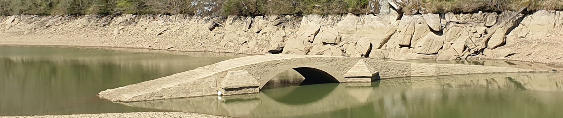
belle
Photos


Positioning
Country:
France
Region :
Bourgogne-Franche-Comté
Department/Province :
Côte-d'Or
Municipality :
Le Val-Larrey
Location:
Flée
Start:(Dec)
Start:(UTM)
602121 ; 5256218 (31T) N.
Comments